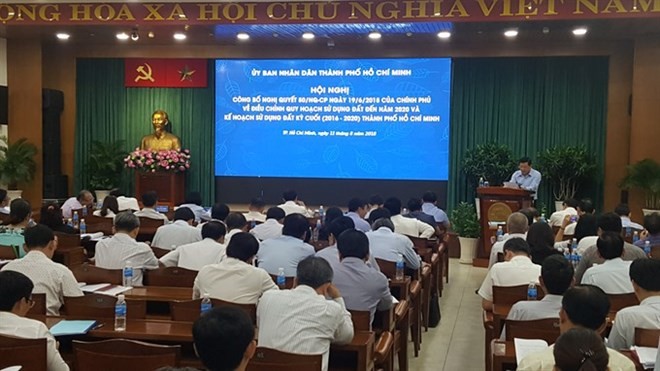
Speaking at a meeting last weekend to announce the Government’s resolution No.80/2018 on the city’s adjusted land-use master plan to 2020, Thang discussed the results of land use in the 2011-2015 period.
“The land-use master plan exploited land potential as an important resource for urban development, but several goals have not been reached, and there has been limited efficiency in land use as well as environmental protection,” he added.
Insufficient investment and site-clearance problems were the major land-use problems facing the city, he said.
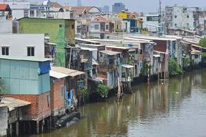
By the end of 2015, around 2,100 hectares of the city’s urban land had not been transferred for land-use goals under the approved master plan.
From now to 2020, the city’s agricultural land will be adjusted downward to 88,000 hectares compared with the 118,000 hectares in 2010.
Meanwhile, non-agricultural land has risen to nearly 189,000 hectares, 1,080 hectares higher than the national target. In 2010, it covered nearly 91,000 hectares.
The land used for infrastructure development in the city is estimated to total around 35,000 hectares, an increase of 15,233 hectares in comparison with 2015. Residential land in the urban area will cover 1,250 hectares.
To implement the adjusted master plan, Thang suggested focusing on five solutions: investment, policies, climate change adaptation, agricultural land fund protection, and implementation.
Thang said the city would also prioritise investments in four satellite urban areas.
In the east, the satellite urban area will be located in Long Truong ward in District 9 near the HCM City - Long Thanh – Dau Giay expressway, on a total area of 280 hectares.
In the west, the satellite urban area will be located in Tan Kien commune in Binh Chanh district near National Highway Number 1, on a total area of 200 hectares.
In the south, it will be located in the A zone in the South Sai Gon Urban Area with the backbone road of Nguyen Huu Tho Boulevard, on a total area of 110 ha.
And in the north, it will be located in the North-West urban area near National Road 22, on a total area of 500 hectares.
To limit the traffic flow to the downtown area, the city will also invest in transportation to connect residential areas and the metro system, now under construction; and public welfare works like schools, hospitals and entertainment facilities.
“The adjusted land-use master plan has updated many standards in urgent fields, especially for climate change, which has become more serious in HCM City,” said Hoang Tung, deputy director of the municipal Master Plan and Architecture Department.
“During the 2020 – 2025 period, half of the land in HCM City will be used for urbanisation,” he added.
“The land-use master plan exploited land potential as an important resource for urban development, but several goals have not been reached, and there has been limited efficiency in land use as well as environmental protection,” he added.
Insufficient investment and site-clearance problems were the major land-use problems facing the city, he said.
By the end of 2015, around 2,100 hectares of the city’s urban land had not been transferred for land-use goals under the approved master plan.
From now to 2020, the city’s agricultural land will be adjusted downward to 88,000 hectares compared with the 118,000 hectares in 2010.
Meanwhile, non-agricultural land has risen to nearly 189,000 hectares, 1,080 hectares higher than the national target. In 2010, it covered nearly 91,000 hectares.
The land used for infrastructure development in the city is estimated to total around 35,000 hectares, an increase of 15,233 hectares in comparison with 2015. Residential land in the urban area will cover 1,250 hectares.
To implement the adjusted master plan, Thang suggested focusing on five solutions: investment, policies, climate change adaptation, agricultural land fund protection, and implementation.
Thang said the city would also prioritise investments in four satellite urban areas.
In the east, the satellite urban area will be located in Long Truong ward in District 9 near the HCM City - Long Thanh – Dau Giay expressway, on a total area of 280 hectares.
In the west, the satellite urban area will be located in Tan Kien commune in Binh Chanh district near National Highway Number 1, on a total area of 200 hectares.
In the south, it will be located in the A zone in the South Sai Gon Urban Area with the backbone road of Nguyen Huu Tho Boulevard, on a total area of 110 ha.
And in the north, it will be located in the North-West urban area near National Road 22, on a total area of 500 hectares.
To limit the traffic flow to the downtown area, the city will also invest in transportation to connect residential areas and the metro system, now under construction; and public welfare works like schools, hospitals and entertainment facilities.
“The adjusted land-use master plan has updated many standards in urgent fields, especially for climate change, which has become more serious in HCM City,” said Hoang Tung, deputy director of the municipal Master Plan and Architecture Department.
“During the 2020 – 2025 period, half of the land in HCM City will be used for urbanisation,” he added.