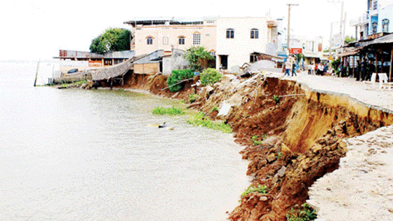
The Mekong Delta has around 265 landside positions with total length of over 450 kilometers; including An Giang, Dong Thap, Bac Lieu, Ca Mau and Hau Giang have been warned as the hot landslide areas.
Since January, around 11 landslides experienced in Hau Giang province, swallowed 2,000 square meters of land.
Delegations from Ministry of Natural Resources and Environment, Ministry of Agriculture and Rural Development constantly verified the localities having river bank landslides to find assistance solutions for local households and reason of the natural disaster.
Around 20 riverbank landslides hit the province every year, caused a damage of VND 100 billion.
Around 20 riverbank landslides hit the province every year, caused a damage of VND 100 billion.
Meanwhile, An Giang has 51 landslide positions stretching 62 kilometers of lands, affected 20,000 households living along riverbanks.
In order to deal with the natural disaster, Ca Mau suggested the central to support around VND 200 billion for building 10,000 kilometers dyke system, and find assistance solutions to move nearly 4,800 households living along rivers out of the damaged zones.
The landslide reason come at flow change and uncontrolled sand exploitation. Additionally, building local hydropower plants is one of reasons affected to landslides.
The Mekong Delta region has suffered reduce of fresh water and alluvium, and serious salt influx.