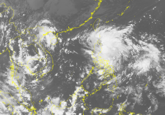
At 1pm, its eye was centered at 15.8 degrees north latitude and 124.9 degrees east longitude with the strongest wind of 40-50 kilometers an hour.
Within next 24 hours, the depression is forecast to move the westward at 20 kilometers per hour.
By 1pm today, the tropical low pressure system will be at 16.1 degrees north latitude and 120.3 degrees east longitude of the westward of the Philippines’s Luzon Island. The powerful wind near the center can gust at level 6- 8.
Because of its circulation, the eastern territorial water of the north and mid- East Sea will experience showery weather, thunderstorm, wind speed of level 5-8 and sea rough.
From October 7-8, the coastal and the north Delta region, the north- central provinces from Thanh Hoa to Ha Tinh continue suffering medium- heavy rains on the large scale with its rainfall of 40-100 mm.
The weather center also warned that the north Delta, the central provinces from Thanh Hoa to Thua Thien- Hue will see a medium- heavy to heavy rain.