It became the first storm hitting Vietnam this year and was named MUN after turning from a tropical low pressure system.
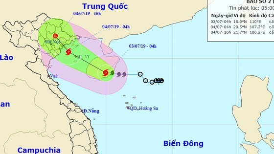
Within the next 24-36 hours, the typhoon will continue moving west- northwest at 10-15 kilometers per hour and develop further as a violent- powered storm hitting the mainland of the Northern provinces between Quang Ninh and Nam Dinh before it respectively weakens into a tropical depression and a low pressure zone in the northern mountainous and midland provinces.
From this afternoon, the Gulf of Tonkin including Bach Long Vi, Co To, Cat Hai and Van Don island districts will suffer sustained winds of level 6- 11 and rough sea.
Because of tropical storm influence, the East Sea’s northwestern territorial waters and the Paracel Islands are warned of gusty winds of level 6-8 and rough sea.
Violent- powered winds of level 6-11 likely to threaten the mainland provinces from Quang Ninh to Ninh Binh.
Due to an impact of the storm circulation, both the Northern, North- Central and mid- Central regions, provinces from Thanh Hoa to Quang Nam are warned of medium- heavy downpours and scattered thunderstorms with an average rainfall of 30-70 mm, even up 100- 250 mm in some places.
Amid the complicated weather, high risks of flash flood and landslide are alerted in dangerous and low- lying areas.