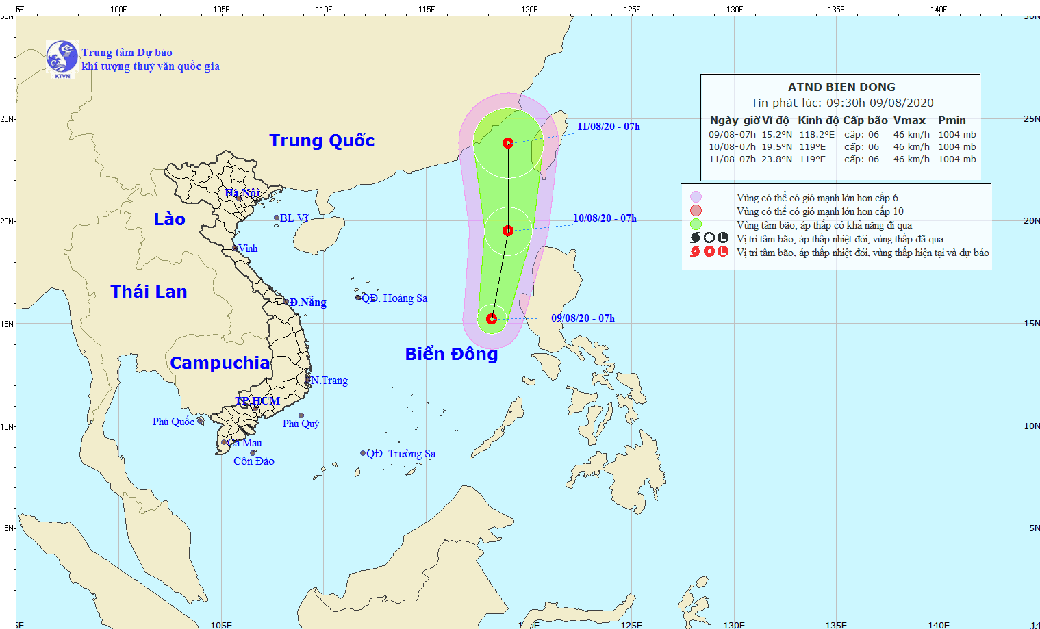
The National Center for Hydro ‑ Meteorological Forecasting (NCHMF) reported that the eye of newly- formed tropical depression has been located at around 200 kilometers far from the Philippines' Luzon Island with sustained winds of 40 to 50 kilometers per hour at 7AM.
In the next 24-48 hours, the dangerous system is expected to move north- northwest at a speed of 15 to 20 kilometers an hour.
Due to the intensity of the southwest monsoon along with the newly- formed tropical depression, the middle of the East Sea including Spratly Islands would see powerful winds of up to level 8, big waves of 2 to 4 meters and rough sea.


