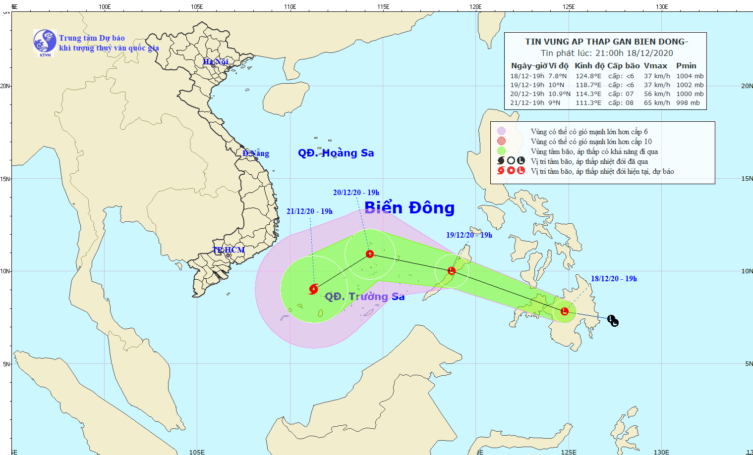
In the next 24- 48 hours, the dangerous system is forecast to keep moving west- northwest with a speed of 15 to 20 kilometers per hour and may intensify into a tropical depression in the East Sea.
By 7PM on Sunday, the eye of tropical depression is able to locate at 10.9 degrees north latitude, 114.3 degrees east longitude at around 80 kilometers far from the Southwest Cay Islet with the blustery winds of 40 to 60 kilometers an hour.
In the next 48- 72 hours, the tropical low pressure system is likely to move southwest and intensify into a storm.
Amid the above-mentioned forecasts, the middle and south- East Sea will see blustery winds, rough sea, big waves and cyclone.