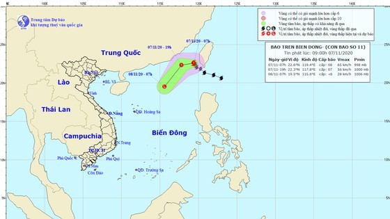
Through Sunday, the tropical storm will move southwest at a speed of 25 kilometers an hour and downgrade gradually to a tropical low- pressure zone.
By 4AM on Monday, the tropical low- pressure zone is expected to fizzle in the Paracel Islands.
Currently, water levels in the upstream of rivers in Quang Nam Province and in Tra Khuc River in Quang Ngai Province are receding gradually. Still water levels in the downstream of rivers in Quang Nam Province tend to rise, possibly triggering risks of landslide, flash flood and flooding in Dong Giang, Nam Giang, Tay Giang, Phuoc Son, Que Son, Tien Phuoc, Nam Tra My, Bac Tra My, Hiep Duc, Nong Son districts in Quang Nam, Ba To, Tien Phuoc, Minh Long, Tra Bong, Son Ha and Son Tay districts in Quang Ngai Province.


