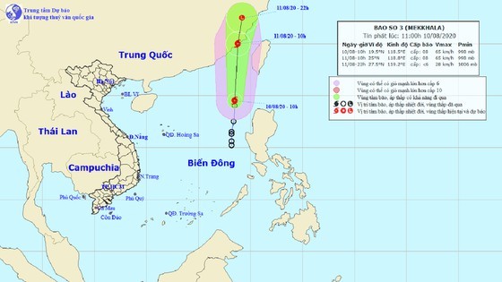
At 10AM, the eye of storm was located in far west- northwest of the Philippines’ Luzon Island around 250 kilometers with maximum sustained winds of 60 to 75 kilometers an hour.
Within the next 24-36 hours, Mekkhala is likely to move northward at a speed of up to 25 kilometers an hour.
By 10AM on Tuesday, the system will move over the mainland of Fujian Province (China) and weaken into a tropical depression and low-pressure zone respectively.
All vessels are heading into huge risks of blustery winds and tropical cyclones in the East Sea so it is necessary to update weather news as well as to be well-prepared for any of the disasters ahead.
Storm Mekkhala along with development of the southwest monsoon will result in sustained winds of level 6-10, 3 to 5-meter big waves and rough sea in the middle of the East Sea.


